Lower Ross Creek
47°32'18.2"N 122°39'23.3"W
Site Overview
Ross Creek on Sinclair Inlet was once a major site for old-growth logging in the South Kitsap area. The creek boasted a timber mill, a rail system, and long piers connecting the area to the legendary Mosquito Fleet of yore, which supported a vibrant workforce in the early years of Port Orchard (then called Sidney).
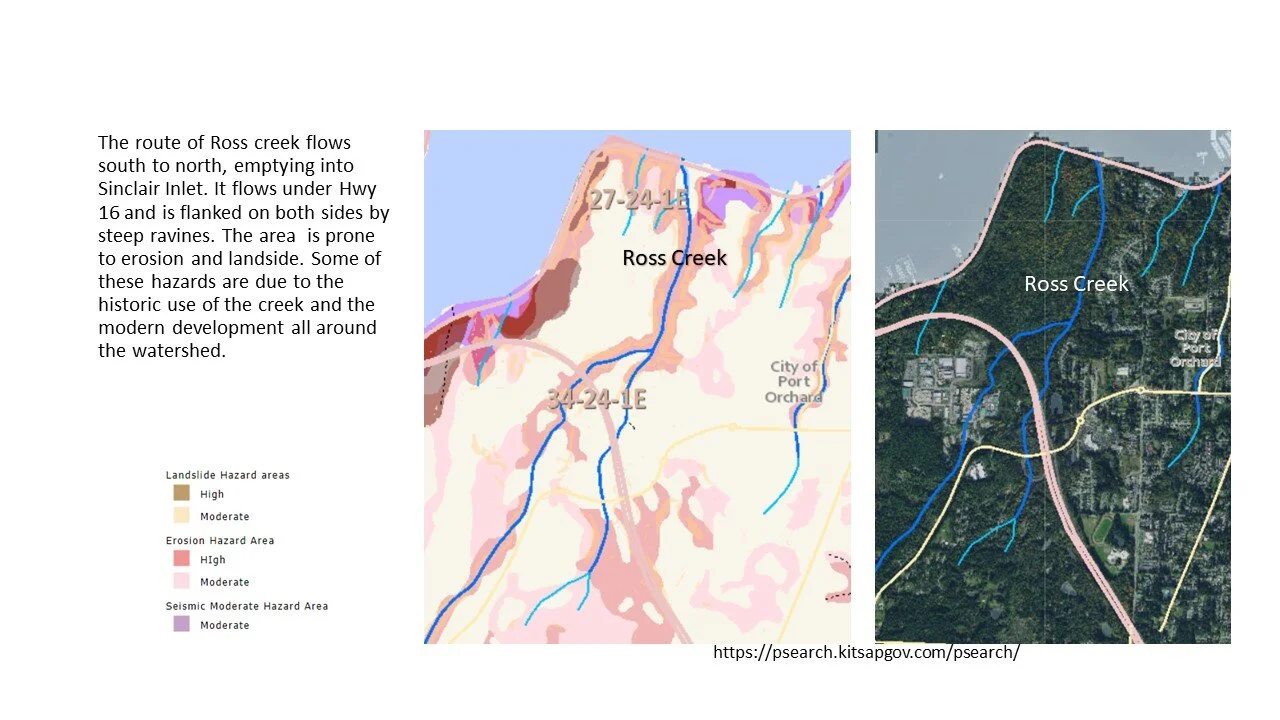
Activity within the Ross Creek system did not stop there, however. In decades past the creek and uplands have been logged, residential development has begun encroaching, and plans are emerging for more development and construction.
After 150 years of activity and impacts Ross Creek is in need of a collaborative effort to restore, preserve, and protect this vital salmon and wetland habitat perched amid growing suburban activity.
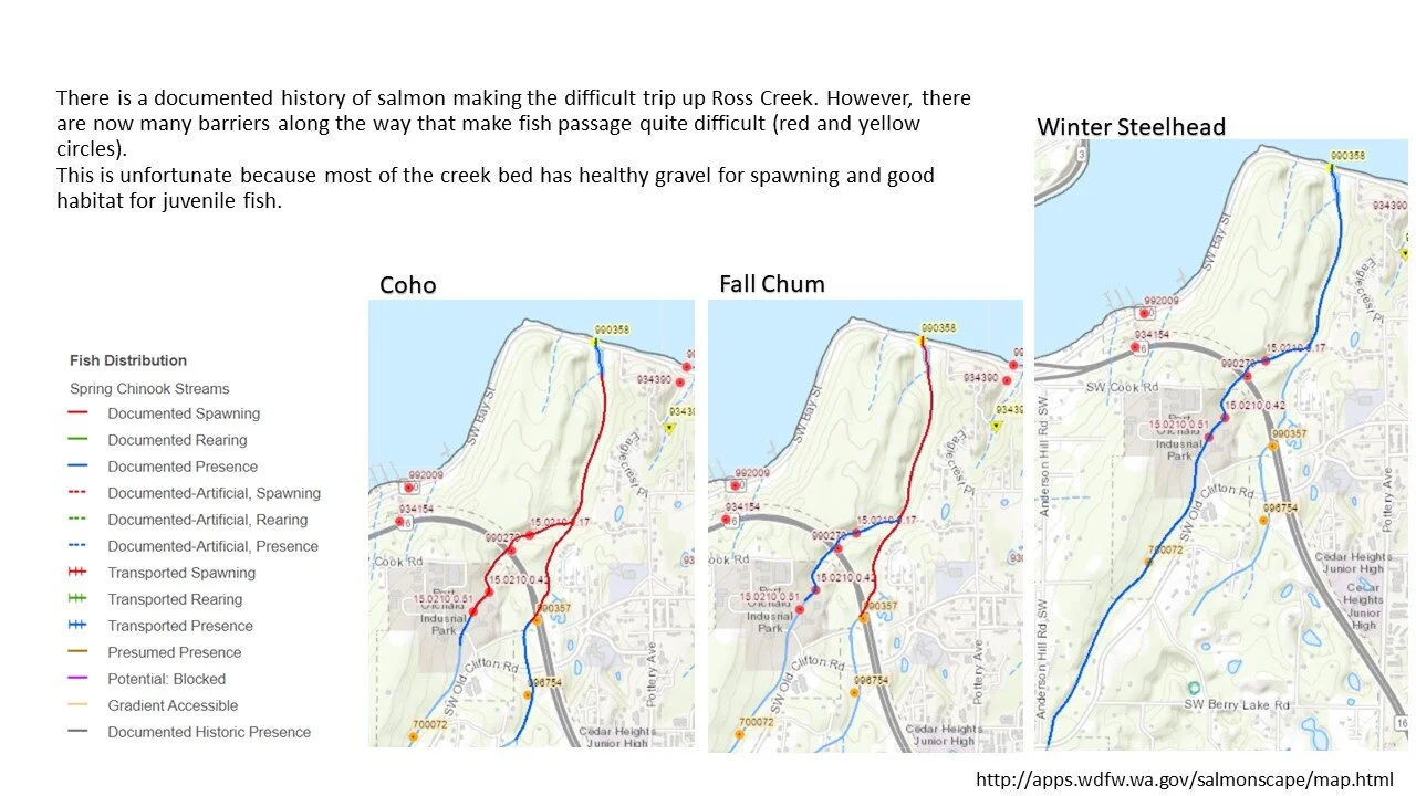
We plan to re-invigorate the Ross Creek watershed and surrounding uplands, to enhance salmon, wetland and estuarine habitat, with the dream to once again return spawning salmon above Highway 16 and beyond.
PROJECT OVERVIEW BULLET POINTS:
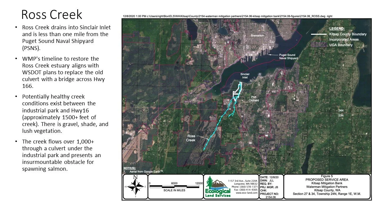
Ross Creek drains into Sinclair Inlet and is less than one mile from the Puget Sound Naval Shipyard (PSNS).
Restoring the Ross Creek estuary will provide much needed mitigation for future development at PSNS.
Marine estuaries with natural tidal flow provide unparalleled biodiversity as well as habitat for young fish.
There is a diminished salmon presence in Ross Creek but the capacity for the creek to support salmon spawning runs and juvenile rearing can be greatly expanded.
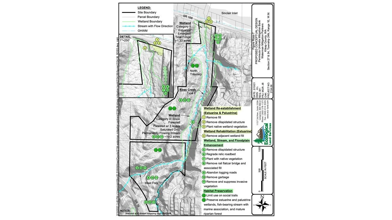
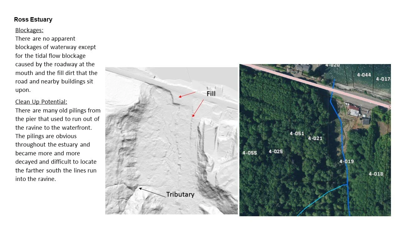
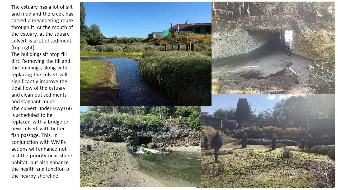
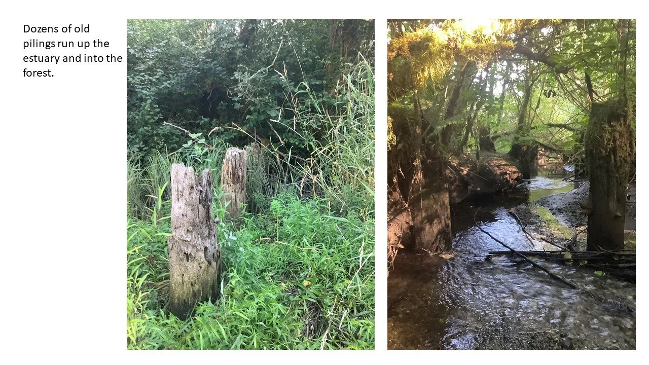
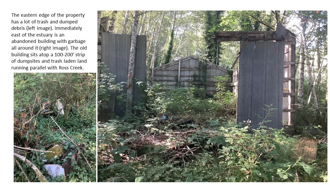
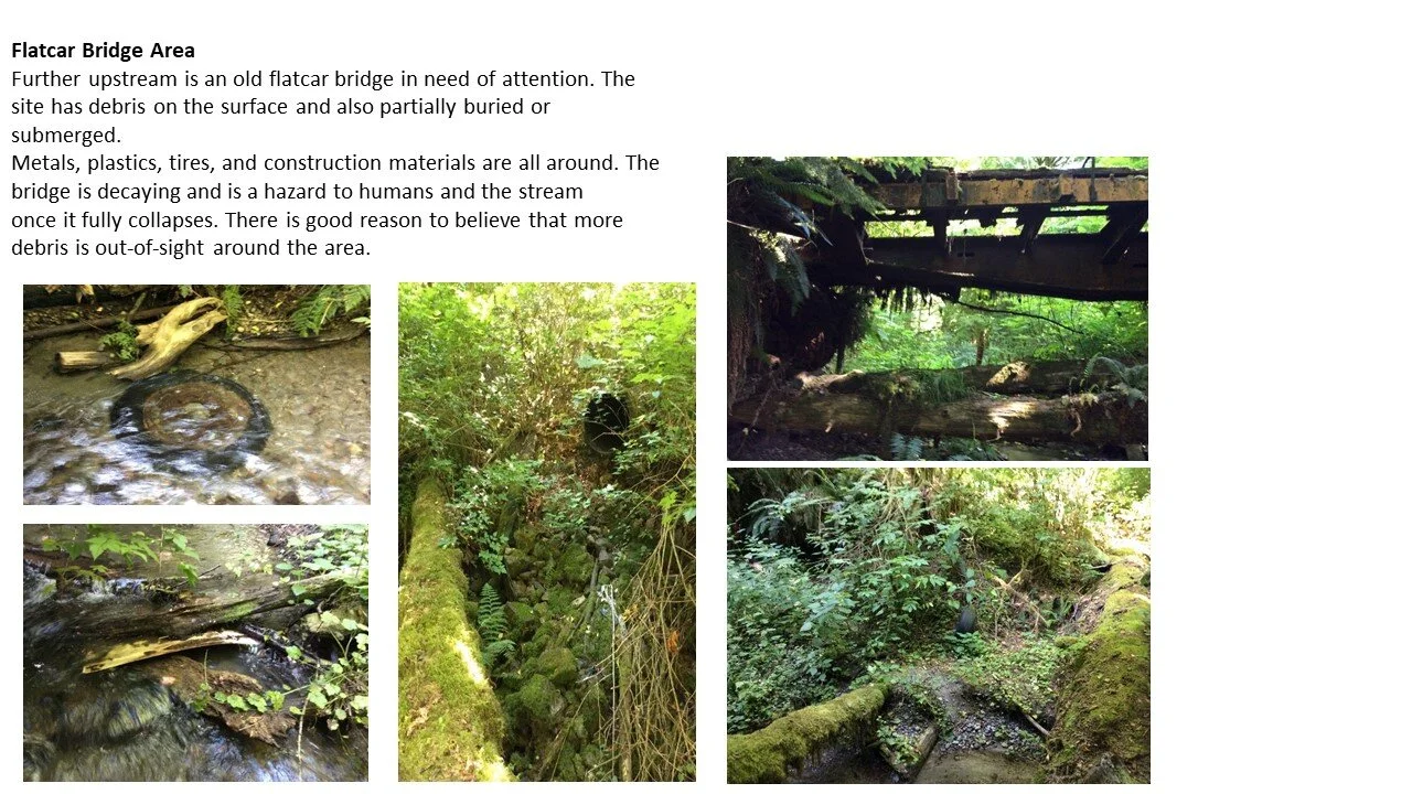
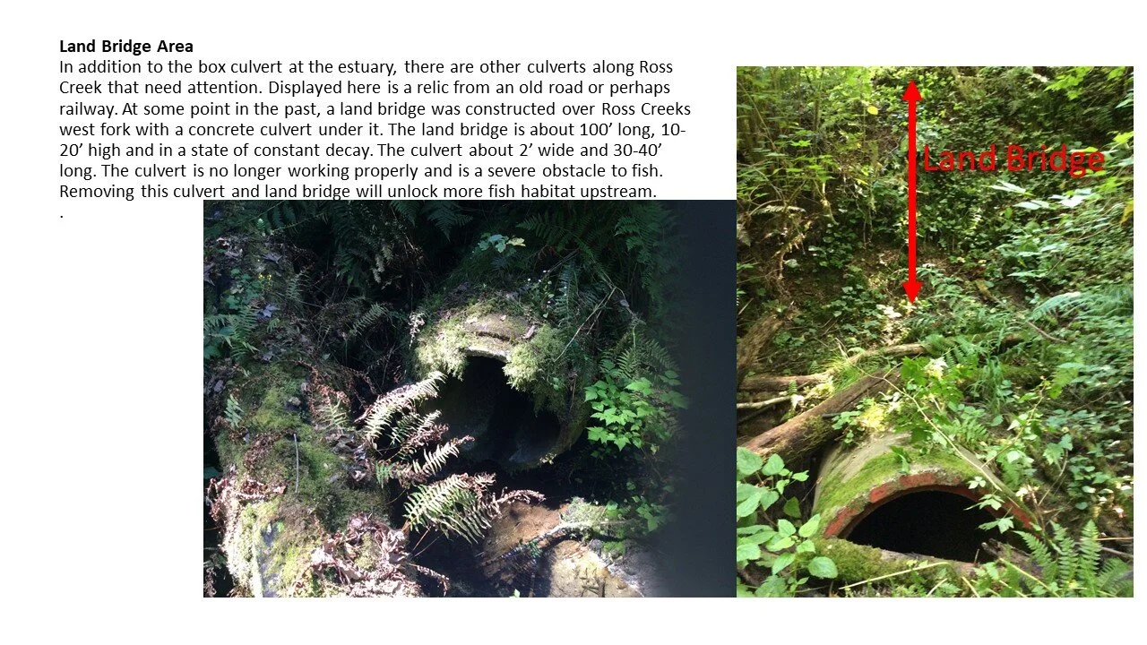
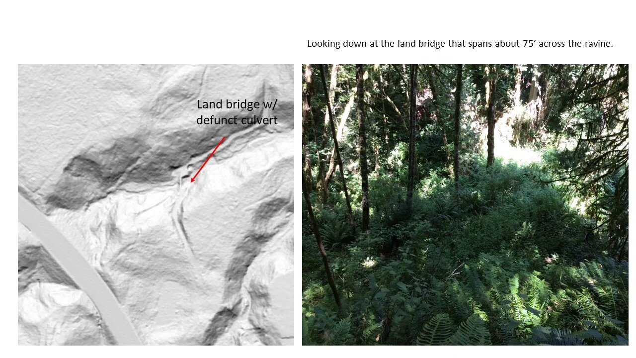
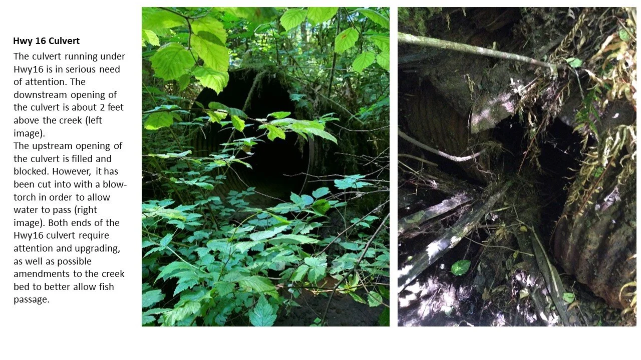
There are many places along the creek where old roads, dilapidated buildings, and decaying bridges have disrupted the creek watershed.
From the mouth to the headwaters, there is potential for restoration and preservation throughout the entire Ross Creek watershed.
WMP's timeline to restore the Ross Creek estuary aligns with WSDOT plans to replace the old culvert with a bridge across Hwy 166.
Project Site
Aerial Video Overview
Aerial footage displays Ross Creek estuary flowing under Hwy 166 into Sinclair Inlet less than one mile from PSNS. We will also look South towards the PO Industrial Park, getting a look at the flow of the creek.

At present the natural tidal flow of the estuary is restricted and the transfer of nutrients is diminished. Replacing the culvert and removing the fill dirt and buildings (center of image) will improve the health and function of the estuary.
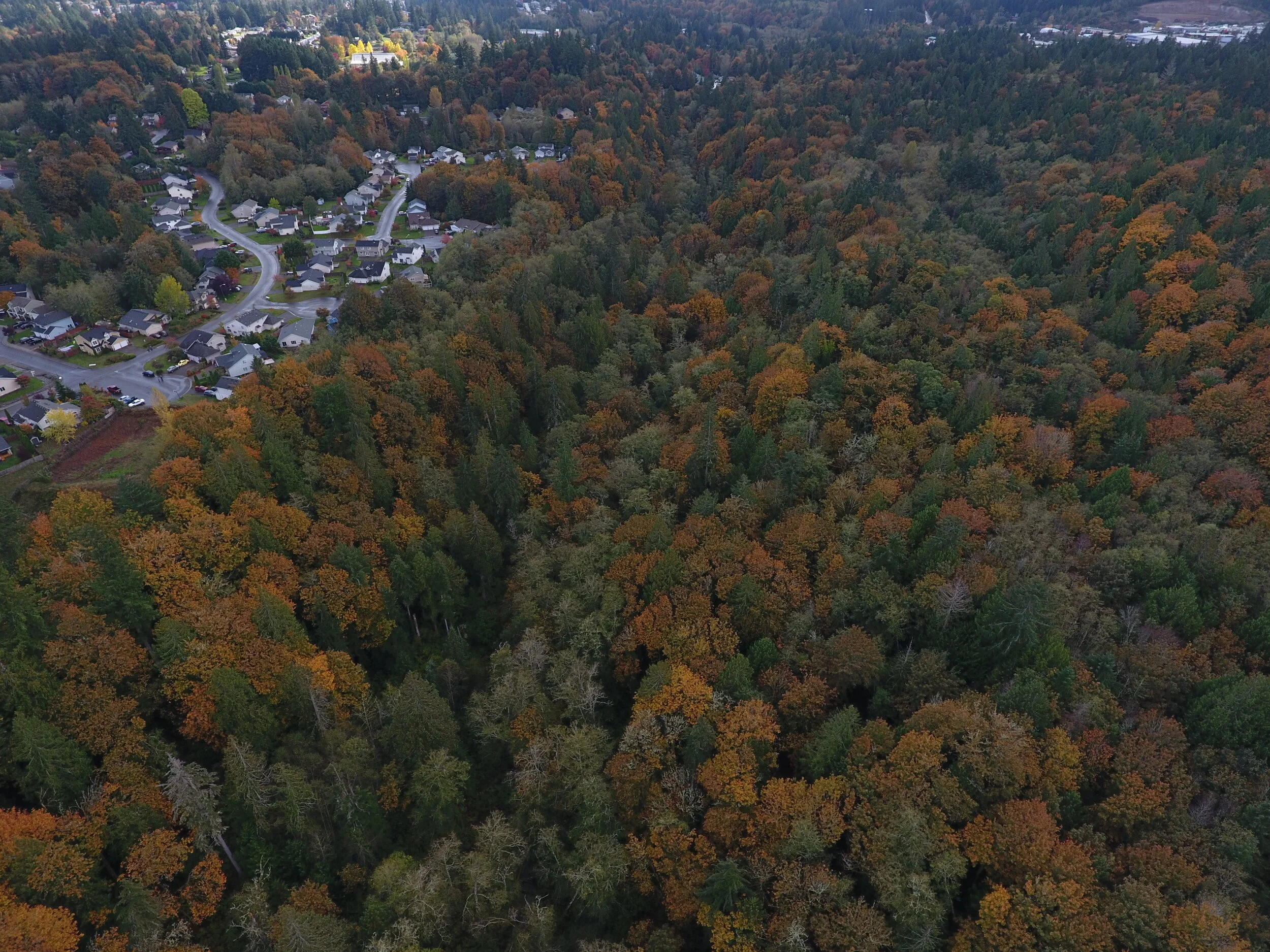
A fold in the forest reveals the course of Ross Creek. In the upper right corner you can see the Port Orchard Industrial Park of Tremont Ave.

Looking west at HWY 166 and the current estuary of Ross Creek.
360 Google Maps Interactive Media
Use your mouse, fingers or track pad to click and drag to explore these interactive 360 photos taken at the Ross Creek estuary where Ross Creek enters a culvert, passes under HWY 166 and flows into Sinclair Inlet.
360 photographs are embedded from Google Maps. To view 360 images on mobile please turn phone to landscape position.