Strawberry Creek
47°38'47.7"N 122°41'44.1"W
Site Overview
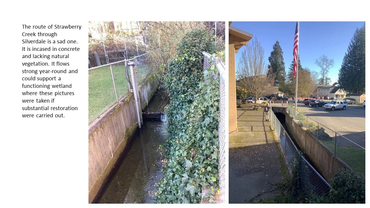
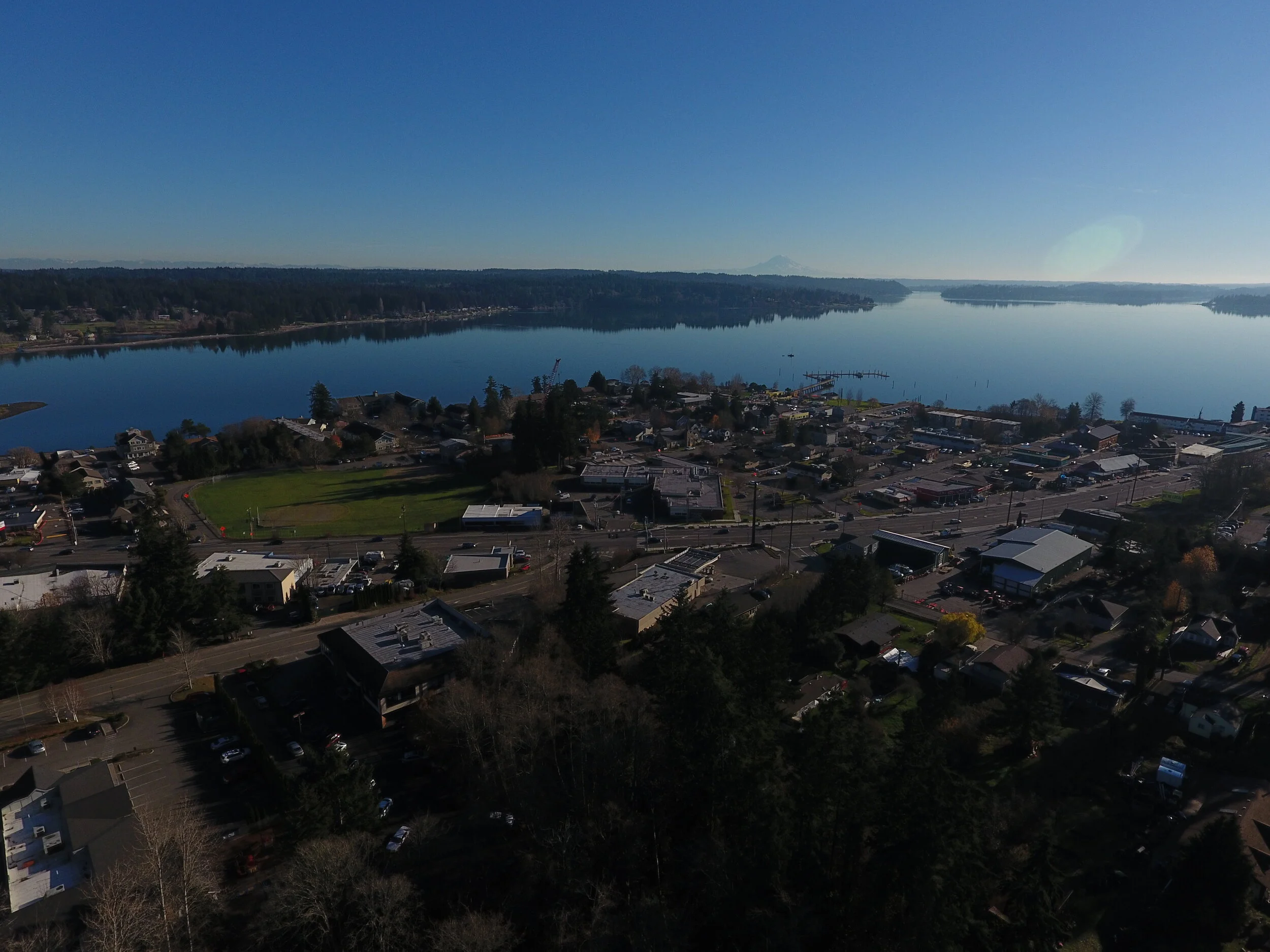
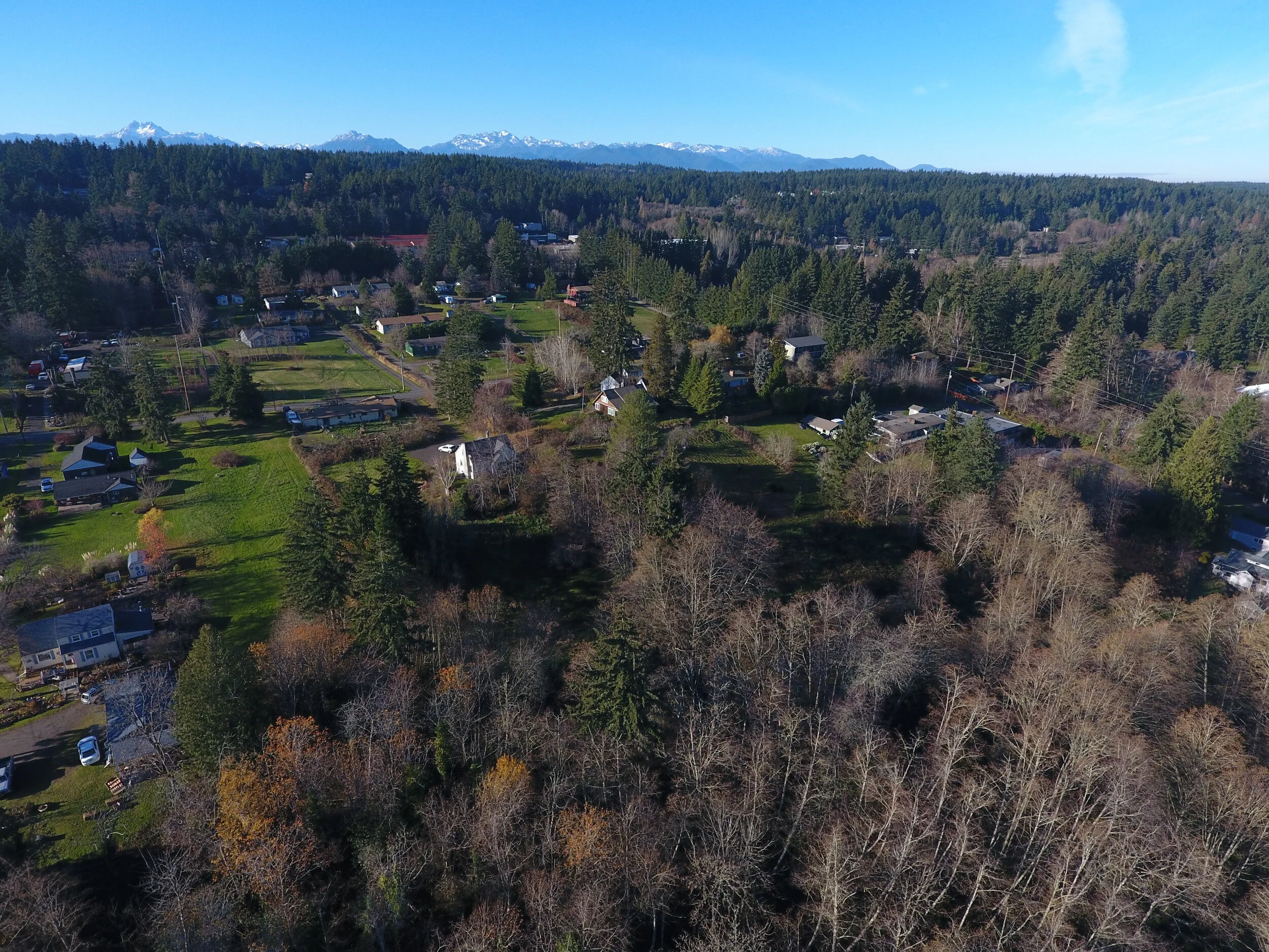
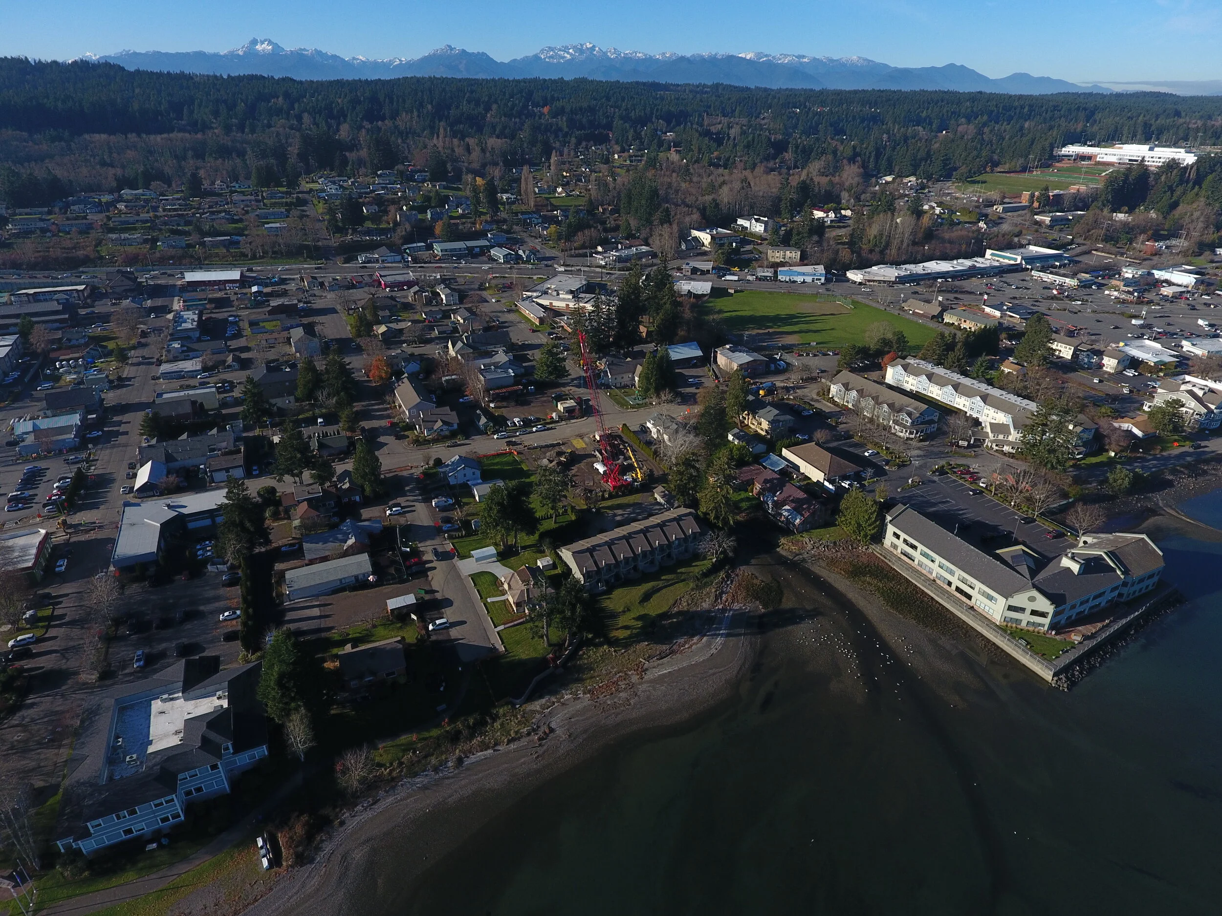
The town of Silverdale has seen substantial development over the last 50 years. Once a farming and suburban residential community, today Silverdale is the commercial hub of Kitsap County and increasingly the location of residential and commercial development. This rapid commercial and urban development has displaced much of the wetland habitat and natural ecosystems of the area. There have recently been efforts to restore some of those ecosystems. The restoration, enhancement, and preservation of Strawberry Creek should be the next chapter in the story of Silverdale. The town, like Kitsap county, stands at an environmental precipice. Waterman Mitigation Partners’ plan for Strawberry Creek is a way to bridge that precipice by showing that this priority riparian and wetland habitat can be restored, sustained and in fact flourish amid development and infrastructure.
PROJECT OVERVIEW BULLET POINTS:
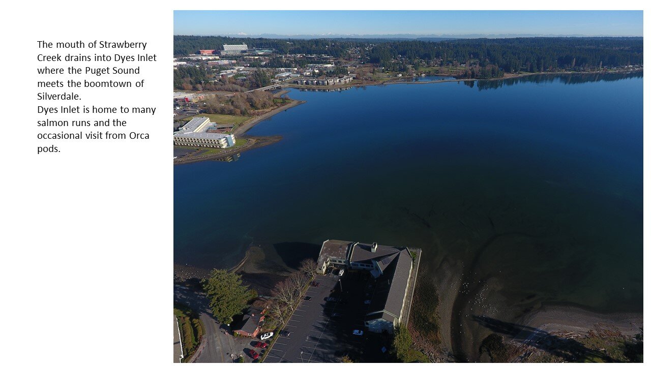
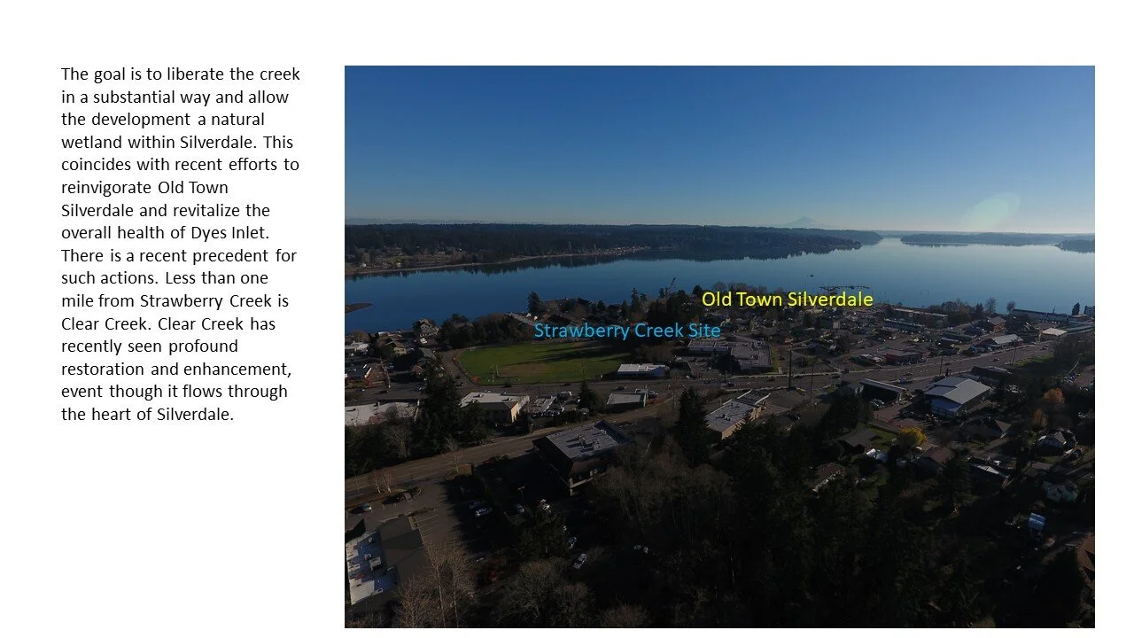
Strawberry Creek drains into Dyes Inlet which boasts multiple salmon runs and the occasional visit by pods of Orca. Adding the Strawberry Creek project to other efforts at Chico Creek and Clear Creek will improve the overall health of this unique branch of the Puget Sound.
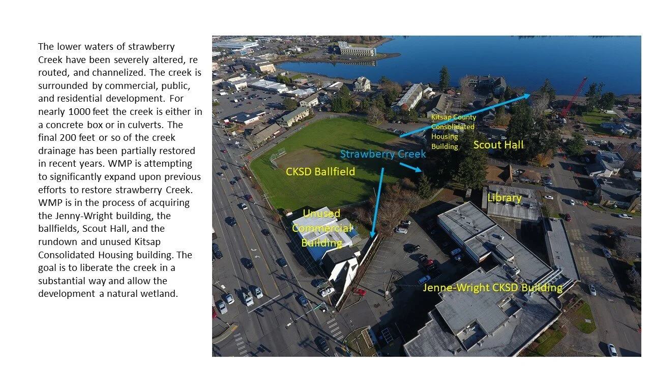
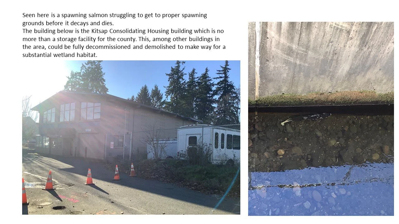
Strawberry Creek has no substantial estuary. However, reclaiming and restoring the commercial and school district lands near to the mouth will provide significant habitat for fish and other wildlife in addition to enhancing the water quality of Dyes Inlet.
WMP has already formed partnerships with the school district, and the county in order to make the restoration of lower Strawberry Creek possible.
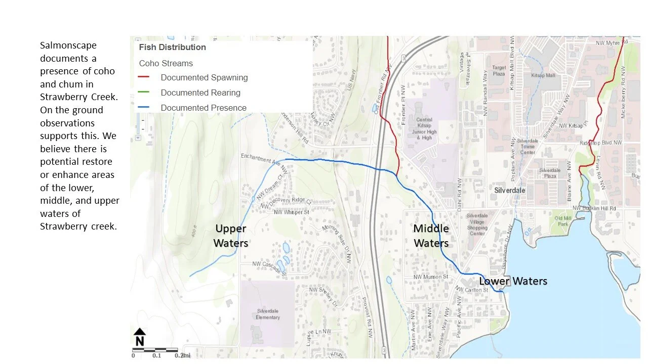
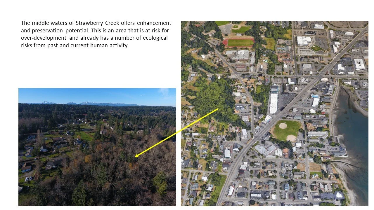
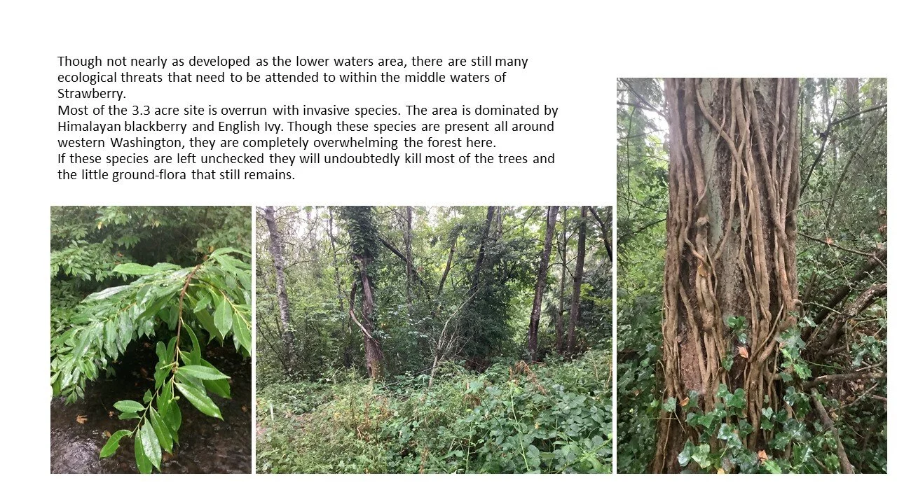
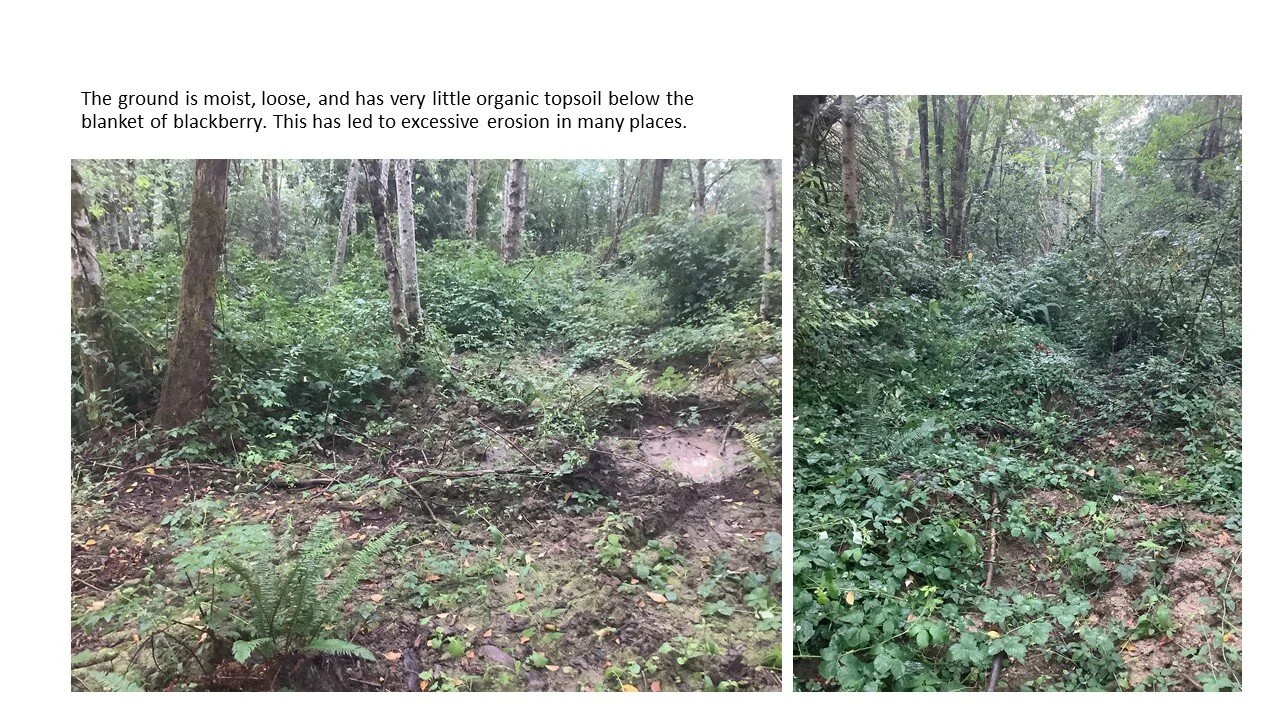
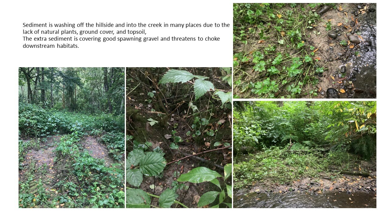
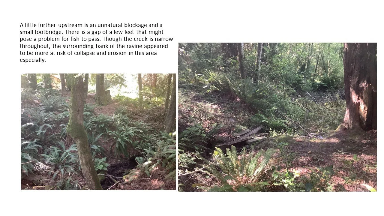
The middle waters, though not as developed as the lower reach of Strawberry, is in need of an ecological helping hand by way of invasive species removal and the stabilization of the soils.
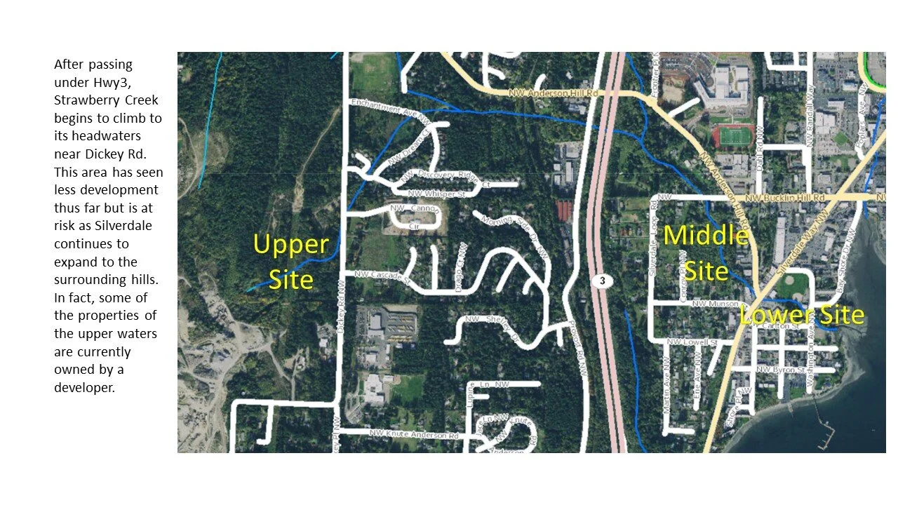
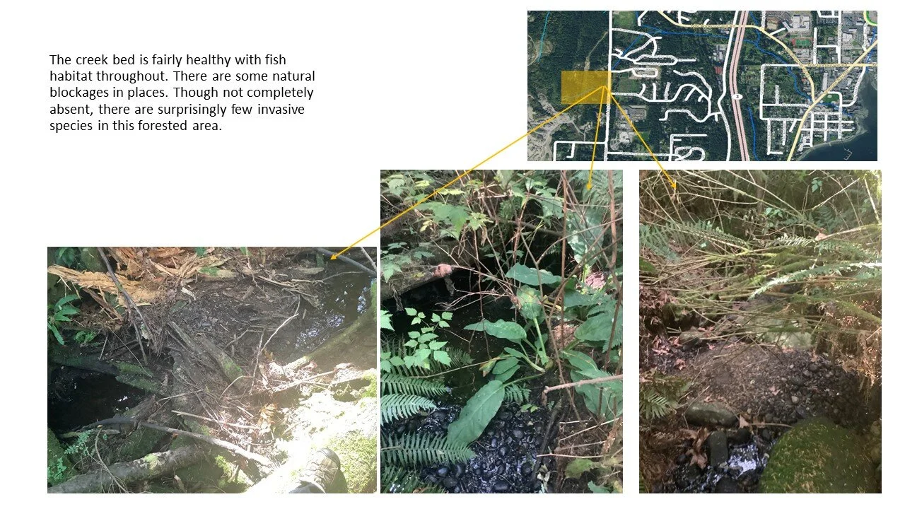
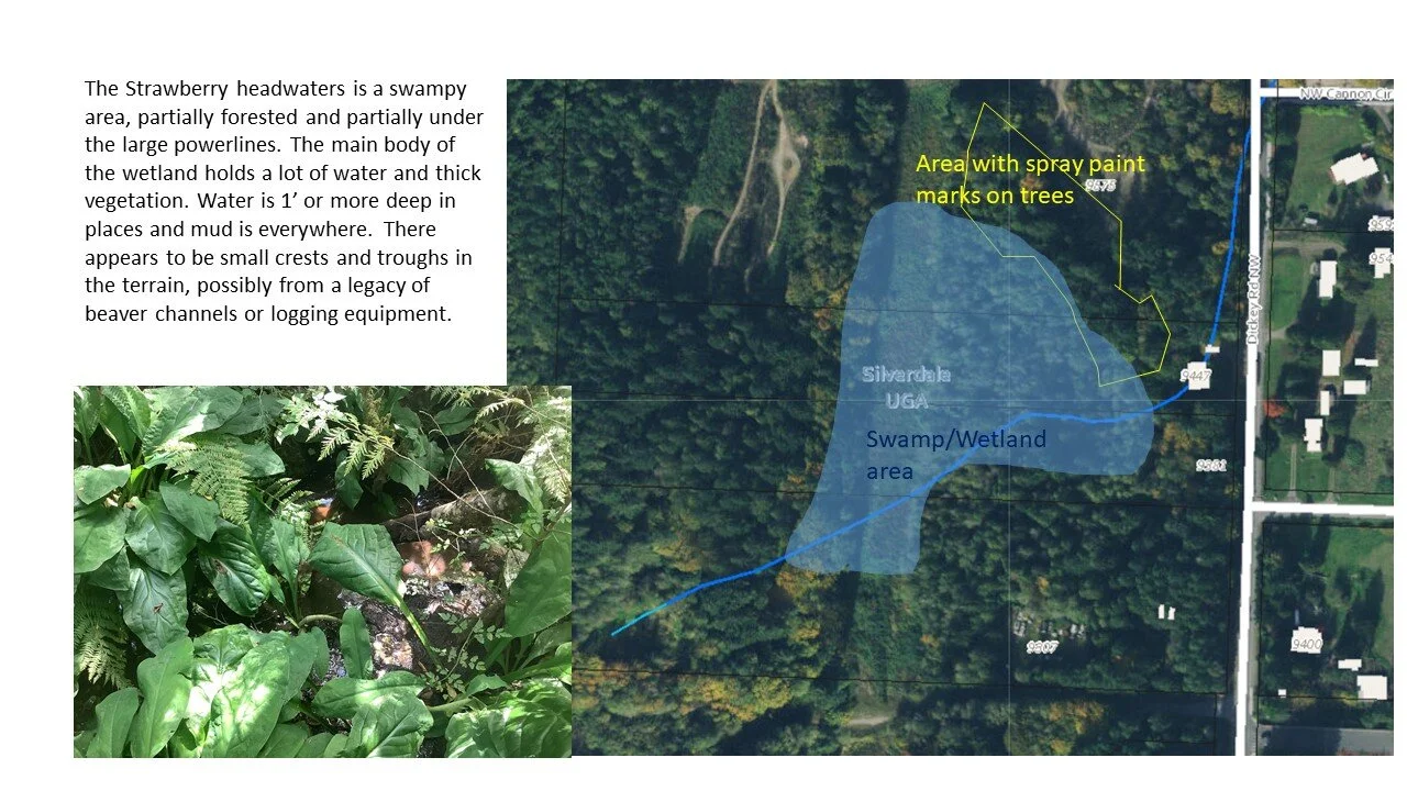
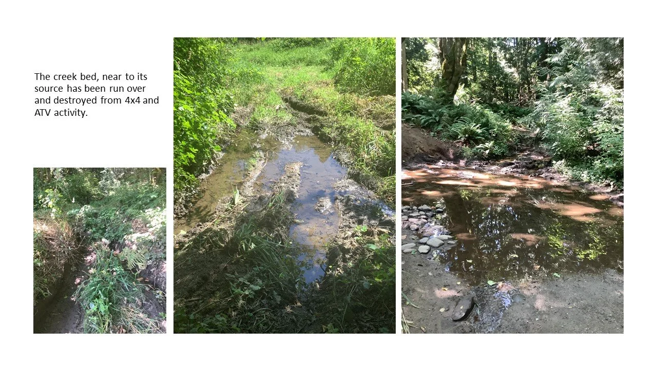
The head waters of Strawberry Creek have provide critical water quality and temperature protection that support and protect the downstream habitat and eventually Dyes Inlet and should be preserved and enhanced.
Project Site
Aerial Video Overview
Aerial footage displays Strawberry Creek as it moves from the greenbelt, under the roadway to a day-lit channel in downtown Siverdale.


360 Google Maps Interactive Media
Use your mouse, fingers or track pad to click and drag to explore these interactive 360 photos taken where Strawberry Creek is a dit lit channel next to the Silverdale Boy Scout hall. 360 photographs are embedded from Google Maps. To view 360 images on mobile please turn phone to landscape position.