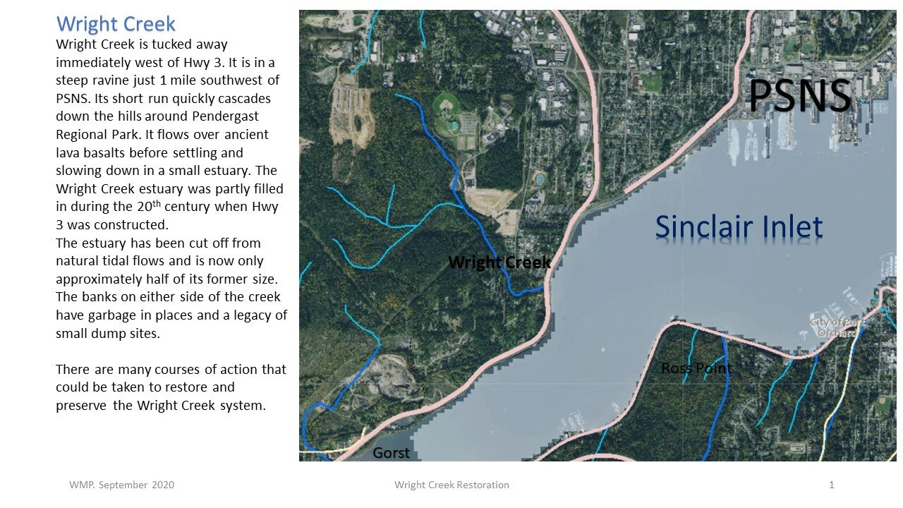
Wright Creek
47°38'47.7"N 122°41'44.1"W
Site Overview
The Wright Creek watershed may seem small and unassuming. In fact, you may have driven by it 1000 times and never even knew it was there. However, Wright Creek offers a restoration opportunity that is increasingly rare in the Puget Sound: restoration of a marine estuary ecosystem.
Timing, as they say, is everything. And many timelines are converging from many entities that could result in the restoration of an important marine habitat. The objectives of multiple entities including WSDOT, environmental and habitat permitting agencies, the Suquamish, the US Navy, and Waterman Mitigation Partners are all aligning in a way that could see four major estuaries of Sinclair Inlet restored, including Wright Creek.
PROJECT OVERVIEW BULLET POINTS:
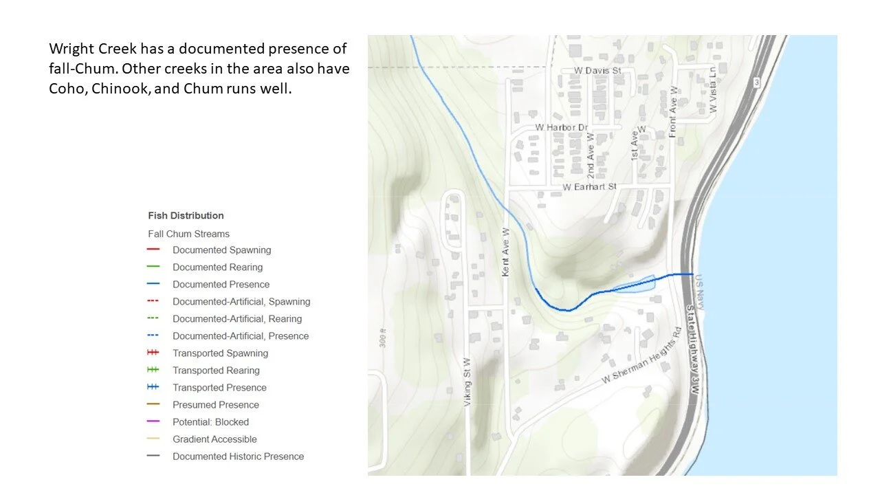
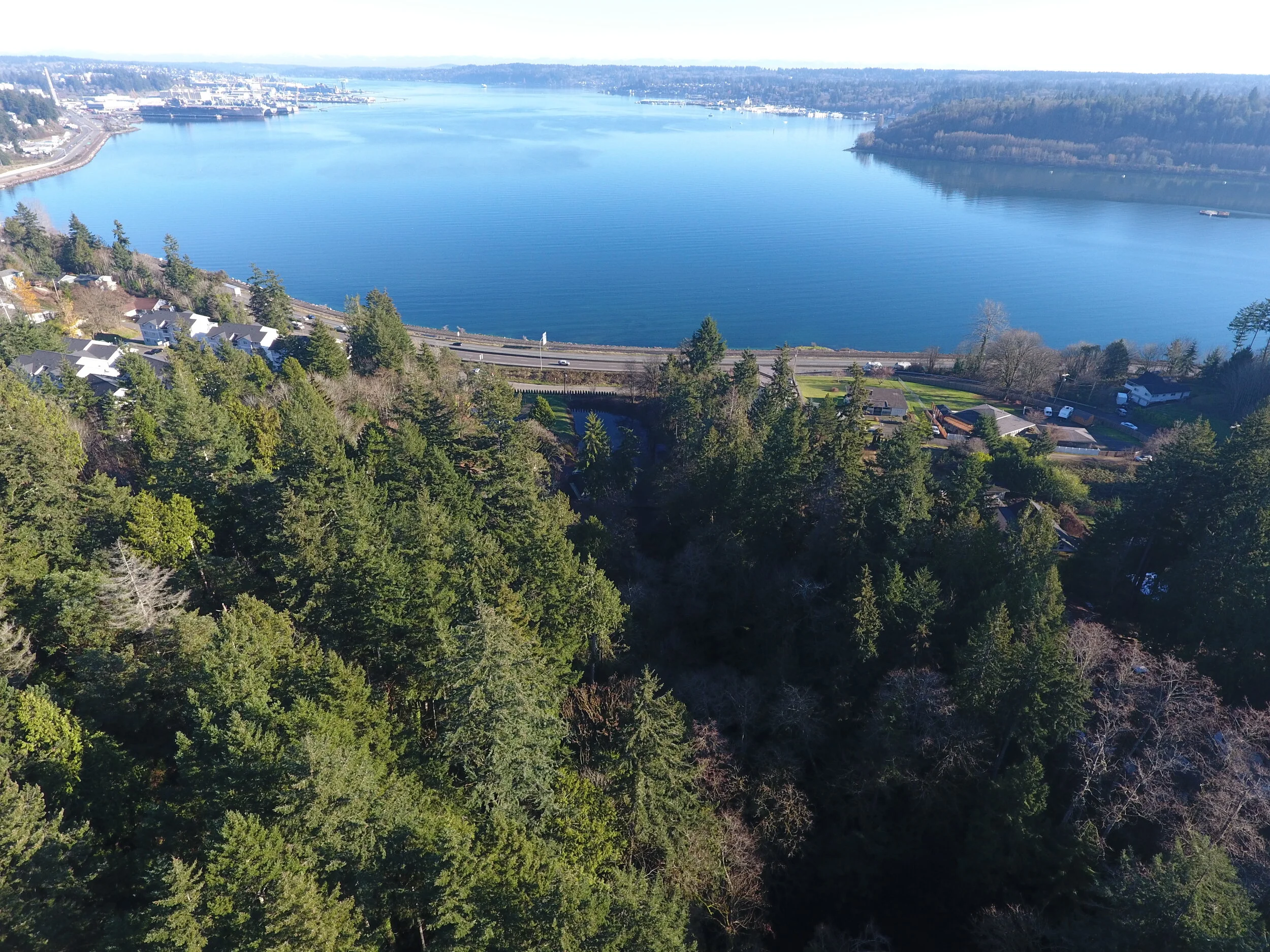
Wright Creek drains into Sinclair Inlet and is less than one mile, as the fish swims, from Puget Sound Naval Shipyard.
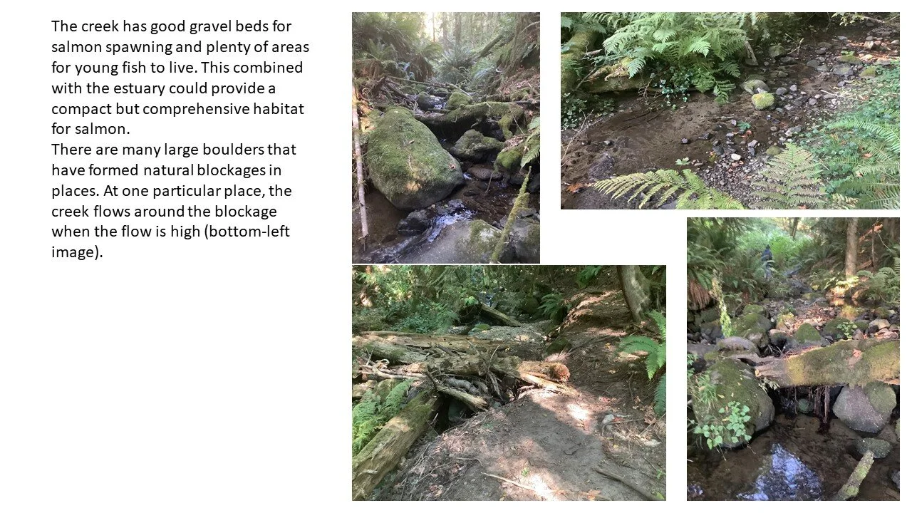
The Wright Creek system has seen nearly two centuries of degradation and human impacts from the headwaters to the mouth.
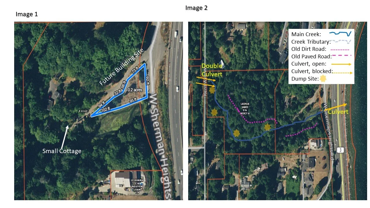
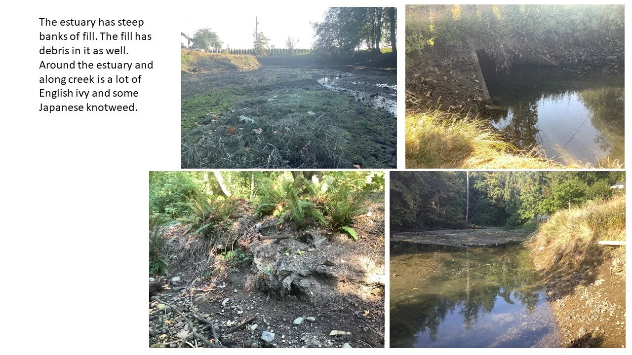
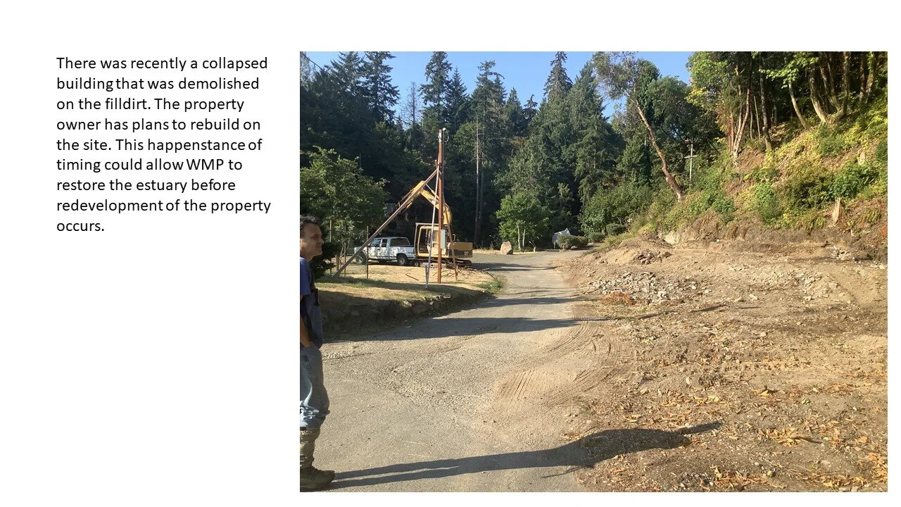
The creek estuary was partially filled during the mid-20th century and structures have been erected over time. The estuary fill area is still threatened by additional human impact and could be developed again if restoration efforts do not move forward soon. Removing the fill dirt and existing structures on fill, regrading and revegetating the estuary would substantially improve the functions of the estuary, including fish and wildlife habitat.
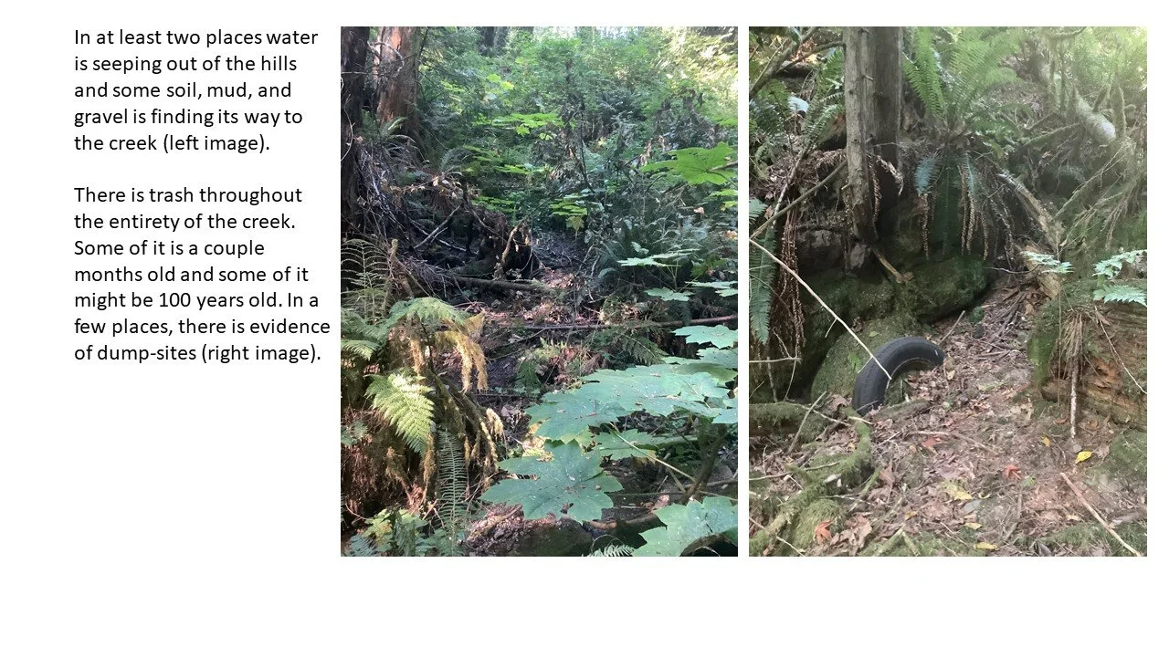
The creek has an unacceptable amount of trash and debris in and around it. There is a legacy of dump sites on or adjacent to the estuary and stream that should be removed to restore the health of the creek.
There is a substantial amount of English ivy along the creek that will be killing trees for decades if left unchallenged.
Project Site
Aerial Video Overview
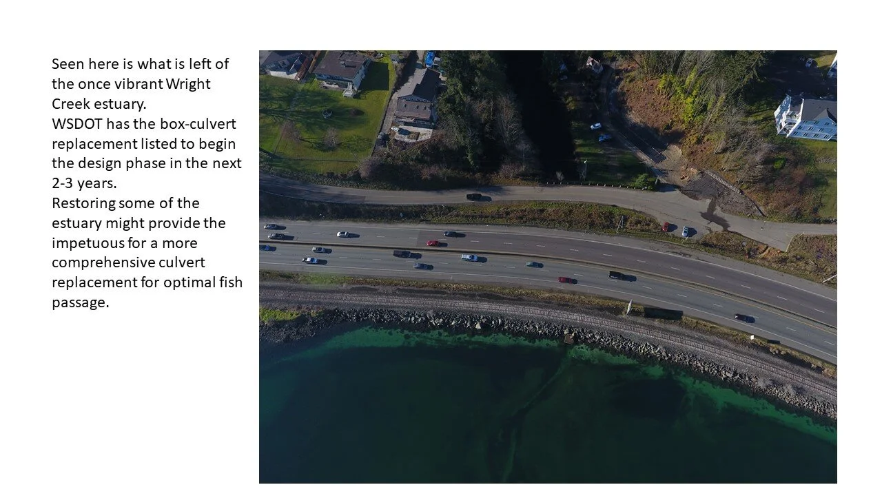
Aerial footage displays Wright Creek as it flows towards Sinclair Inlet through an impacted estuary and culvert..


360 Google Maps Interactive Media
Use your mouse, fingers or track pad to click and drag to explore these interactive 360 photos taken where Strawberry Creek is a dit lit channel next to the Silverdale Boy Scout hall. 360 photographs are embedded from Google Maps. To view 360 images on mobile please turn phone to landscape position.