
Yang’s
port orchard
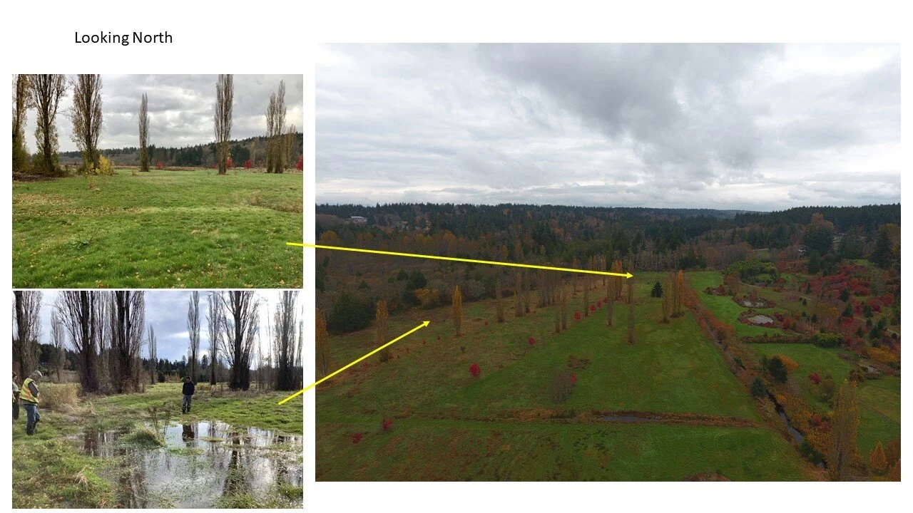
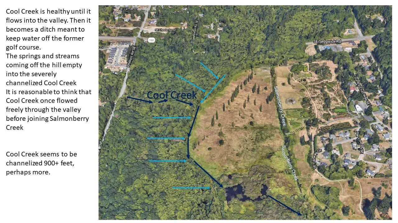
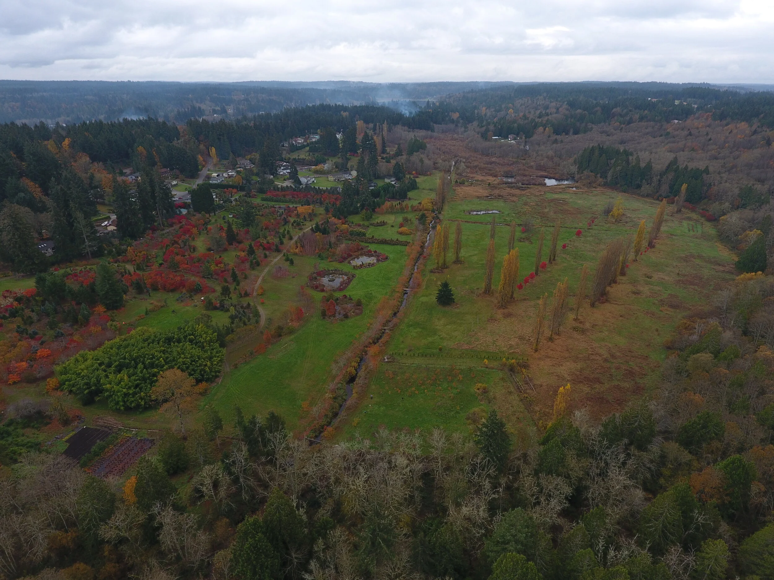
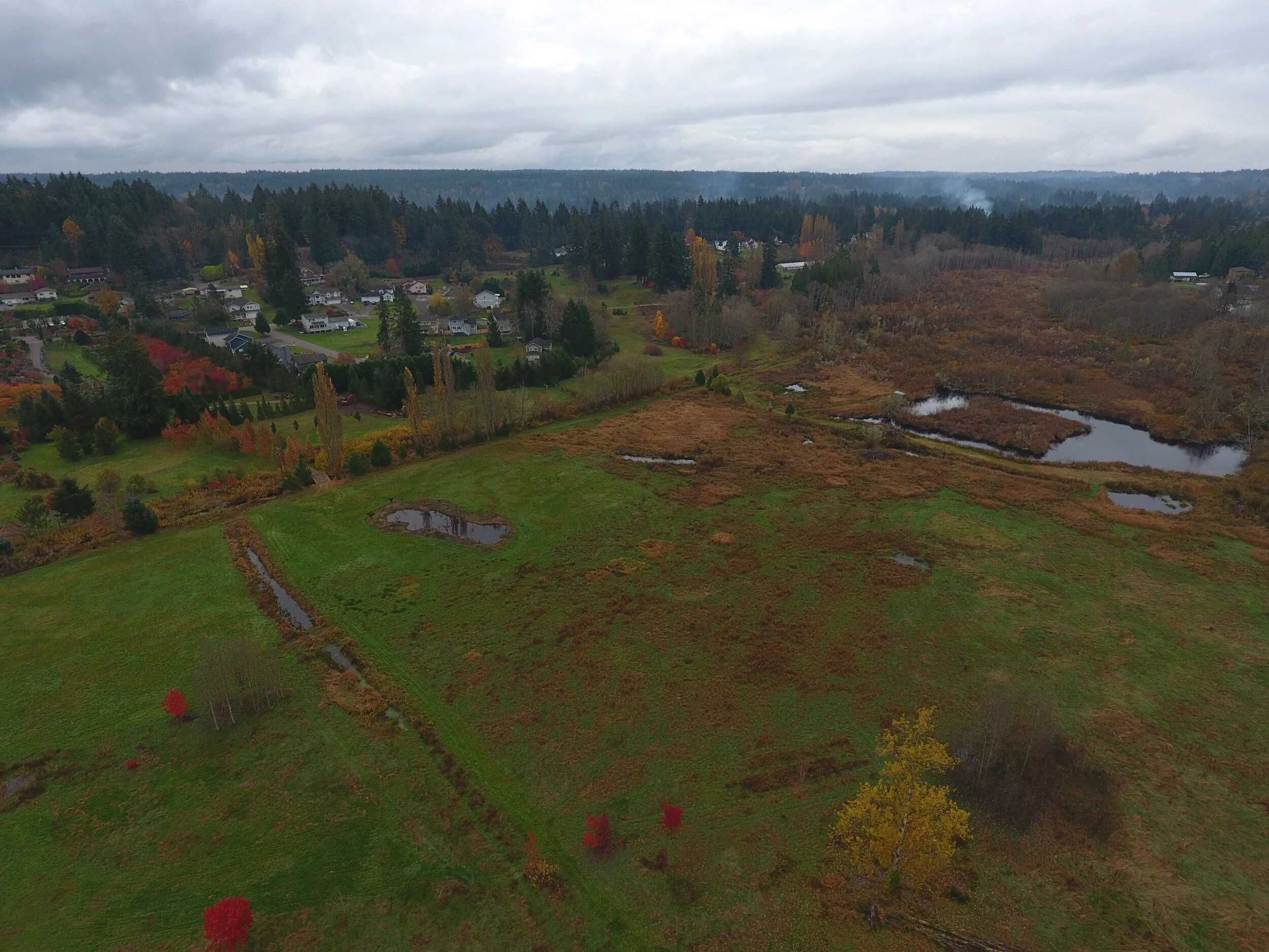
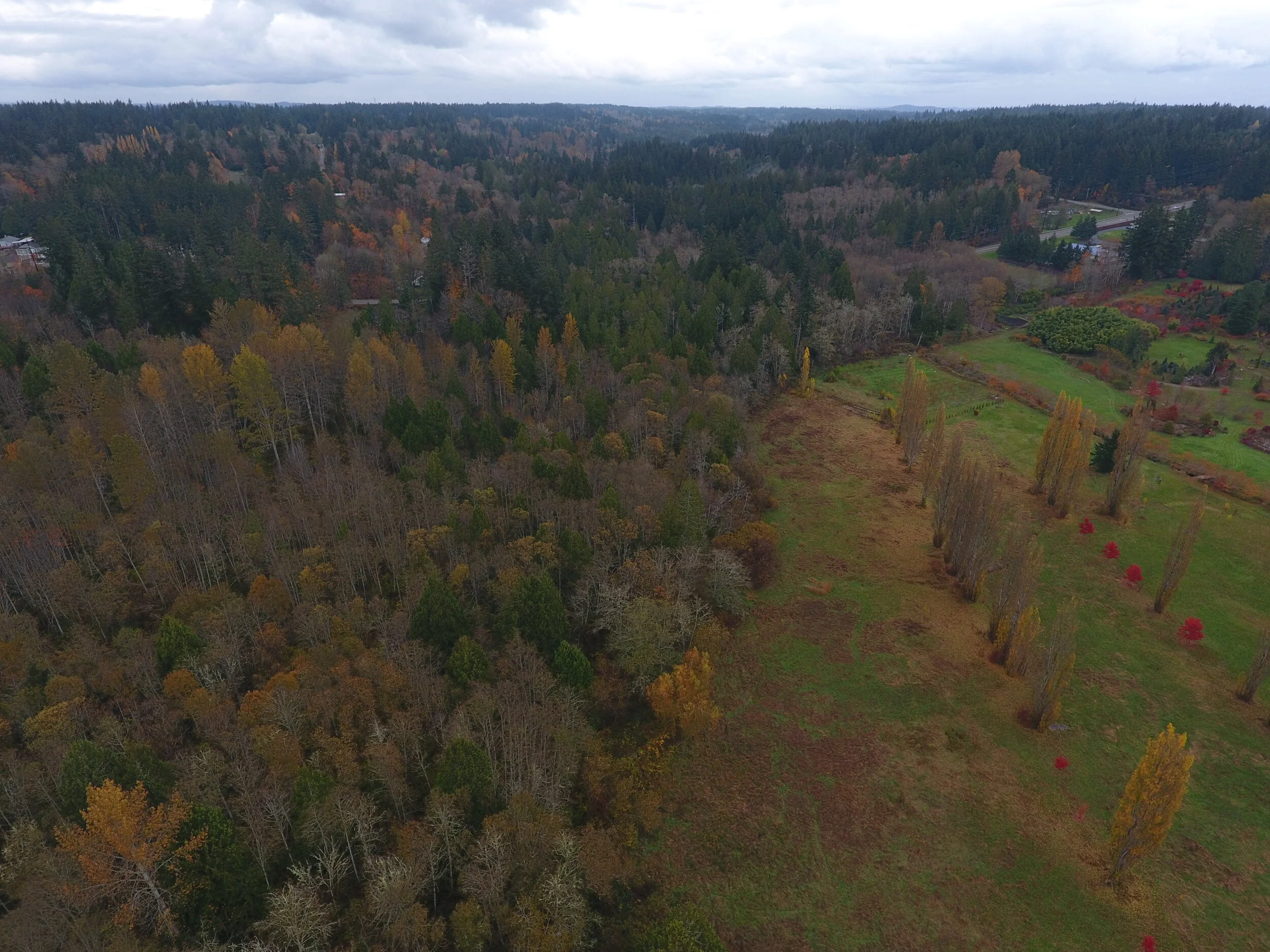
Project Site Drone Overview
Aerial footage displays Clover Valley / Yang’s Botanical Garden in relation to Sedgwick Rd. + Salmonberry Creek.

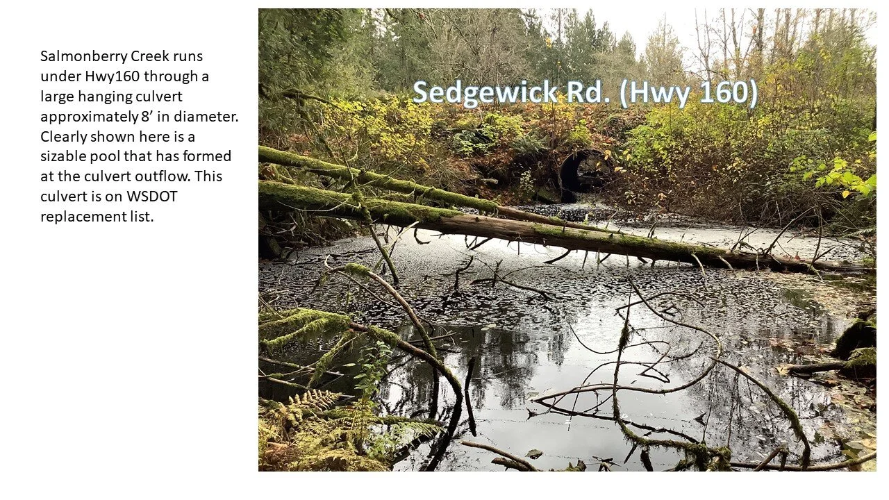
Google 360 Interactive Photos
Use your mouse or finger to explore these 360 embedded photos from Google Maps showing the derelict bridge over Salmonberry Creek and the Culvert on Sedgwick Rd.